
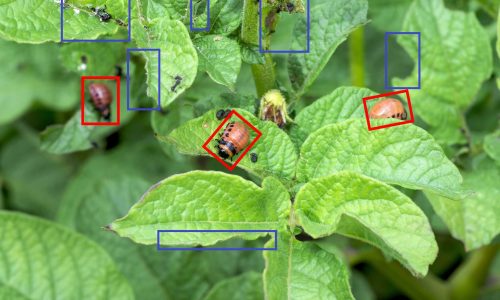
Why is Agriculture Data Annotation Services Important?
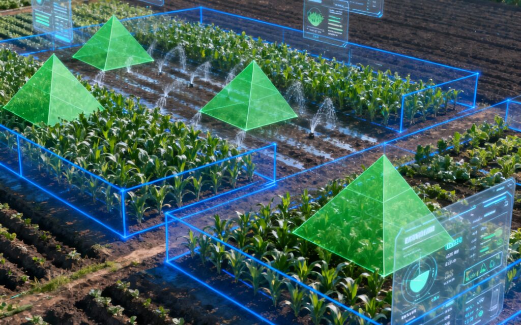
AI-driven agriculture relies on high-quality annotated data to:
- Detect crop diseases, pest infestations, and nutrient deficiencies.
- Monitor crop growth stages and estimate yield.
- Identify weeds, soil conditions, and irrigation needs.
- Optimize resource usage through precision farming techniques.
- Analyze satellite or drone imagery for large-scale farm management.
Proper annotation ensures AI models can distinguish between healthy and unhealthy plants, classify crop types, and predict potential risks—ultimately improving productivity, sustainability, and profitability in farming.
Types of Agriculture Annotation
Image and Video Annotation
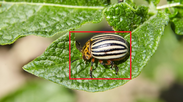
Bounding boxes and polygons mark plants, fruits, and pest-affected areas. Semantic segmentation labels different zones such as soil, crop canopy, and water bodies. Keypoint annotation is used to track plant growth or identify specific crop parts like leaves and stems. Video annotation enables time-lapse analysis for growth monitoring and harvesting automation.
Aerial Annotation
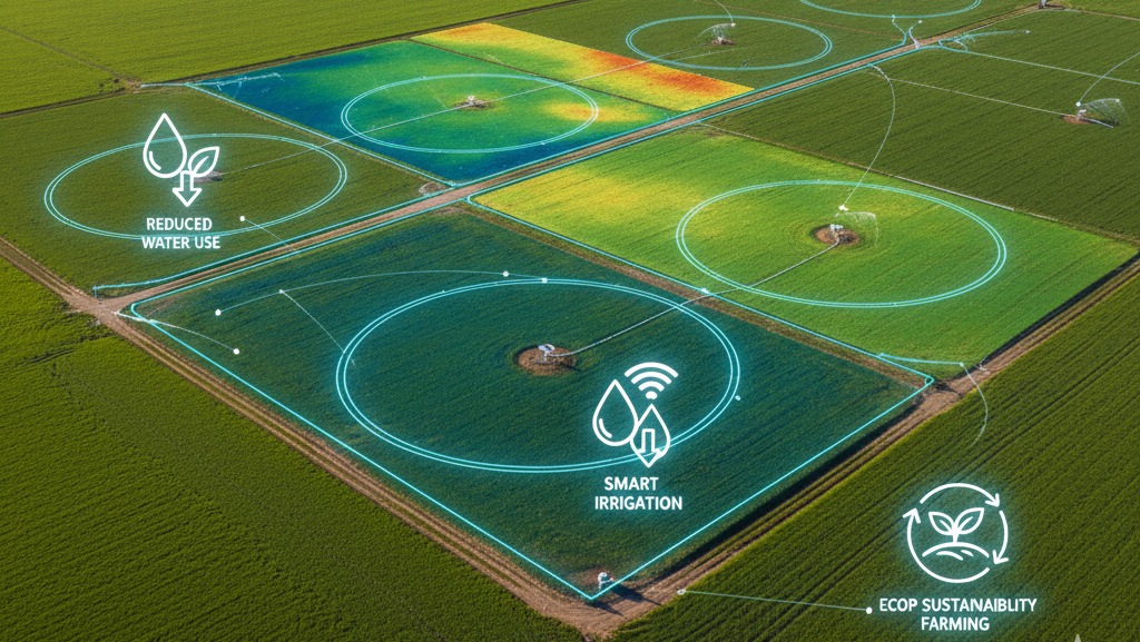
Drone and satellite imagery are annotated to map fields, detect irrigation issues, and classify crop types. Polylines and polygons outline field boundaries, irrigation lines, and farm infrastructure, while LiDAR data helps create 3D field models for terrain analysis.
Multispectral & Sensor Data Annotation
AI models use annotated multispectral images and IoT sensor readings to analyze soil moisture, chlorophyll content, and vegetation indices like NDVI. Annotating these datasets allows accurate prediction of crop health and early detection of environmental stress.
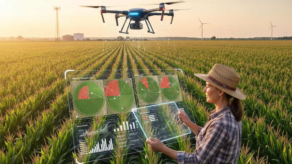
Agriculture Data Annotation Services for Precision Farming AI
Advanced Data Annotation for Smart Agriculture
Artificial intelligence and machine learning are transforming modern agriculture through precision farming, automated crop monitoring, plant disease detection, and intelligent agricultural analysis.
These technologies rely on accurately labeled agricultural datasets to identify crops, detect weeds, monitor plant health, classify soil conditions, and analyze changes across farmland.
Annotation World provides agriculture data annotation services to support the development of AI-powered agricultural technologies. We help prepare structured training datasets using ground-level images, drone footage, satellite imagery, multispectral images, and agricultural videos.
From crop image annotation and plant disease labeling to aerial image segmentation and vegetation analysis, our annotation solutions support machine learning and computer vision applications in agriculture.
Our Agriculture Data Annotation Services
1. Crop Image Annotation
Crop image annotation involves identifying and labeling plants, crops, leaves, fruits, and other agricultural objects within images.
Our crop annotation workflows can include:
- Crop and plant identification
- Leaf and stem annotation
- Fruit and vegetable labeling
- Plant growth stage classification
- Crop counting and localization
- Healthy and unhealthy plant classification
These labeled datasets can support AI applications involving crop identification, plant monitoring, and automated agricultural analysis.
2. Crop Disease and Pest Detection Annotation
Plant disease and pest detection models require labeled images that help AI systems recognize visible symptoms and identify affected plant regions.
Our annotation workflows can support:
- Leaf disease image annotation
- Diseased plant region identification
- Pest and insect detection
- Leaf damage annotation
- Disease classification labeling
- Healthy versus affected plant classification
- Disease severity categorization based on project guidelines
These datasets can support the development of computer vision models for plant disease recognition and agricultural monitoring.
3. Weed Detection and Segmentation
Weed detection annotation helps train AI models to distinguish unwanted vegetation from cultivated crops.
Common annotation tasks include:
- Weed bounding box annotation
- Weed and crop classification
- Pixel-level weed segmentation
- Crop row identification
- Weed density labeling
- Field-level vegetation classification
These datasets can support precision spraying, automated weed monitoring, and agricultural robotics applications.
4. Drone and Aerial Image Annotation
Drone imagery provides detailed visual information about agricultural fields and crop conditions.
Our aerial annotation workflows can include:
- Agricultural field boundary annotation
- Crop row identification
- Plant and tree detection
- Irrigation infrastructure mapping
- Vegetation segmentation
- Land cover classification
- Crop damage identification
- Farm infrastructure annotation
These annotations can support precision agriculture, field mapping, and automated crop monitoring systems.
5. Satellite Image Annotation
Satellite imagery enables large-scale agricultural monitoring and geospatial analysis.
Our satellite image annotation workflows can support:
- Agricultural land classification
- Field boundary identification
- Crop type classification
- Vegetation mapping
- Water body identification
- Land-use classification
- Temporal change detection
- Agricultural infrastructure mapping
These labeled datasets can support remote sensing applications and AI-powered agricultural land analysis.
6. Multispectral and Hyperspectral Image Annotation
Multispectral and hyperspectral imaging capture information across multiple wavelength bands, providing additional information beyond conventional RGB images.
Annotation workflows can be designed for:
- Vegetation classification
- Crop health analysis
- Plant stress region identification
- Spectral image classification
- Soil and vegetation differentiation
- Multiband image segmentation
These datasets can support machine learning applications involving vegetation analysis and agricultural remote sensing.
7. NDVI and Crop Health Annotation
The Normalized Difference Vegetation Index (NDVI) is commonly used to assess vegetation greenness using remote sensing imagery.
NDVI-related annotation workflows can include:
- Vegetation region classification
- Crop canopy segmentation
- Healthy and stressed vegetation labeling
- Field-level vegetation classification
- Temporal vegetation change annotation
- Crop health category labeling based on defined thresholds
These annotations can support AI models designed for crop monitoring and vegetation analysis.
8. Agricultural Video Annotation
Agricultural video annotation involves identifying and labeling objects and activities across video frames captured by drones, field cameras, and agricultural machinery.
Common tasks include:
- Crop and plant detection
- Fruit and vegetable tracking
- Agricultural machinery detection
- Harvesting activity annotation
- Field operation labeling
- Plant movement and growth monitoring
- Video-based object tracking
These datasets can support agricultural robotics, automated harvesting, and computer vision applications.
9. Soil and Irrigation Mapping
Agricultural AI applications may use image-based and geospatial datasets to analyze soil conditions, irrigation infrastructure, and field characteristics.
Annotation workflows can include:
- Soil type image classification
- Soil surface segmentation
- Irrigation channel identification
- Water body annotation
- Field boundary mapping
- Irrigation infrastructure labeling
- Waterlogging and flood-affected area identification
These datasets can support AI-based land analysis and precision irrigation applications.
Agriculture AI and Precision Farming Applications
Agriculture data annotation can support several machine learning and computer vision applications.
Crop Disease Detection
Labeled plant images help train AI models to recognize visible disease symptoms and classify affected crop regions.
Precision Farming
Annotated field imagery can support AI systems designed to monitor crop conditions and improve field-level agricultural analysis.
Automated Weed Detection
Crop and weed segmentation datasets can support machine learning models used in automated weed identification and precision spraying.
Crop Monitoring and Growth Analysis
Annotated images and videos can help identify plant growth stages, crop density, and changes in vegetation over time.
Agricultural Robotics
Object detection, segmentation, and tracking datasets can support robots designed for harvesting, field navigation, and agricultural operations.
Yield Estimation and Prediction
Annotated crop images, aerial imagery, and field datasets can contribute to the development of machine learning models for crop counting and yield estimation.
Agricultural Remote Sensing
Satellite and drone imagery annotation can support land classification, crop mapping, vegetation monitoring, and agricultural change detection.
Agricultural Annotation Techniques
Different agricultural AI applications require different annotation methods depending on the data type and model objectives.
Bounding Box Annotation
Bounding boxes identify and locate crops, fruits, leaves, weeds, insects, and agricultural equipment within images.
Polygon Annotation
Polygon annotation outlines irregular regions such as crop fields, vegetation areas, leaves, and damaged plant regions.
Semantic Segmentation
Semantic segmentation assigns a category to every pixel in an image to distinguish crops, weeds, soil, water, and other agricultural features.
Instance Segmentation
Instance segmentation identifies individual plants, fruits, trees, or other objects separately, even when they belong to the same category.
Polyline Annotation
Polyline annotation identifies linear features such as crop rows, irrigation channels, field boundaries, and agricultural pathways.
Keypoint Annotation
Keypoint annotation identifies specific points of interest, such as plant structures, fruit attachment points, and other project-defined landmarks.
Our Agriculture Data Annotation Workflow
A structured annotation workflow helps maintain consistency across agricultural image, video, and geospatial datasets.
- Project Assessment – Review the agricultural data, annotation objectives, dataset volume, and project requirements.
- Annotation Guidelines – Define crop categories, plant labels, disease classes, segmentation rules, and expected output formats.
- Data Preparation – Organize and prepare ground-level images, drone footage, satellite imagery, and other supplied datasets.
- Annotation Execution – Perform the agreed image, video, aerial, and multispectral data annotation tasks.
- Quality Assurance – Review labels for consistency, completeness, and adherence to project guidelines.
- Final Delivery – Deliver structured annotated datasets in the mutually agreed formats.
Quality Assurance for Agricultural Datasets
Agricultural datasets can contain significant variations in lighting, weather, plant growth stages, geographical conditions, and image quality.
A project-specific quality assurance process can include:
- Standardized annotation guidelines
- Consistent crop and vegetation categories
- Review of bounding boxes and segmentation masks
- Label consistency checks
- Identification of missing or incorrect annotations
- Dataset completeness verification
- Final output validation
Clear annotation guidelines and representative datasets are important for preparing reliable agricultural AI training data.
Why Choose Annotation World?
Annotation World provides data annotation solutions for organizations developing AI and machine learning applications across different industries.
Our agriculture annotation capabilities can support multiple data types and labeling requirements, including:
- Crop and plant image annotation
- Disease and pest detection labeling
- Weed detection and segmentation
- Drone and satellite image annotation
- Multispectral image annotation
- NDVI and vegetation classification
- Agricultural video annotation
- Soil and irrigation mapping
We focus on project-specific annotation guidelines, structured workflows, and quality review to help prepare training datasets for agricultural AI and precision farming applications.
Whether you are developing crop disease detection models, agricultural robotics, remote sensing solutions, or automated crop monitoring systems, our team can discuss an annotation workflow aligned with your project requirements.
Frequently Asked Questions
What is agriculture data annotation?
Agriculture data annotation is the process of labeling agricultural images, videos, drone imagery, satellite data, and other datasets to train AI and machine learning models for farming and agricultural applications.
What types of agricultural data can be annotated?
Common data types include crop images, plant photographs, drone footage, satellite imagery, multispectral images, hyperspectral images, and agricultural videos.
What is crop disease annotation?
Crop disease annotation involves labeling plant images to identify disease symptoms, affected leaves, pest damage, and other visible crop health conditions for AI model development.
What is precision agriculture data annotation?
Precision agriculture data annotation involves preparing labeled datasets from field images, drone imagery, satellite data, and other agricultural sources to support AI-driven farming applications.
Can drone images be used for agricultural data annotation?
Yes. Drone images can be annotated to identify crop fields, vegetation, irrigation infrastructure, field boundaries, crop damage, and other agricultural features.
What is NDVI annotation in agriculture?
NDVI annotation involves labeling and classifying vegetation-related regions in imagery based on project-defined NDVI values and thresholds. It can support crop monitoring and remote sensing AI applications.
What is weed detection annotation?
Weed detection annotation identifies and labels unwanted vegetation in agricultural images to train computer vision models for weed identification and precision farming.
How does agricultural image segmentation work?
Agricultural image segmentation assigns pixel-level labels to crops, weeds, soil, leaves, fruits, and other regions to help AI models understand agricultural scenes.
How can I get started with agriculture data annotation services?
Contact Annotation World with your agricultural dataset details, data type, annotation categories, approximate volume, and preferred output format. Our team can discuss a suitable annotation workflow for your project.
Get Started with Agriculture Data Annotation
Developing an AI-powered agricultural solution that requires accurately labeled training datasets?
Annotation World can help prepare crop images, drone imagery, satellite data, multispectral images, and agricultural videos for your machine learning and computer vision projects.
Contact our team to discuss your agriculture data annotation requirements and project scope.