
LiDAR and Radar Annotation for AI and Autonomous Driving
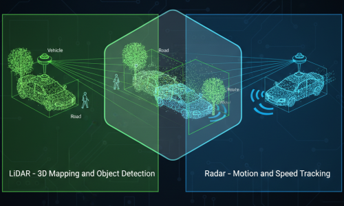
LiDAR and radar annotation are important data labeling processes used to train AI models to understand their surroundings. LiDAR captures 3D spatial information, while radar provides measurements that can help estimate an object’s distance, relative speed, and direction of movement.
AnnotationWorld provides data annotation services for AI and machine learning projects. Annotation workflows can be tailored to LiDAR point clouds, radar detections, object tracking, and sensor fusion requirements.
How LiDAR Is Used in Annotation
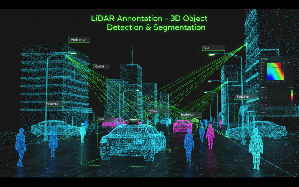
In AI datasets, LiDAR data is annotated to help models understand the 3D world. Typical annotation tasks include:
- 3D Bounding Boxes – Drawing boxes around vehicles, pedestrians, trees, or other objects in 3D space.
- Segmentation – Labeling each LiDAR point according to object type (e.g., road, car, building).
- Sensor Fusion Annotation – Merging LiDAR data with camera images for more accurate labeling.
- Depth & Distance Mapping – Annotating the relative distance of each object from the sensor.
How Radar Is Used in Annotation
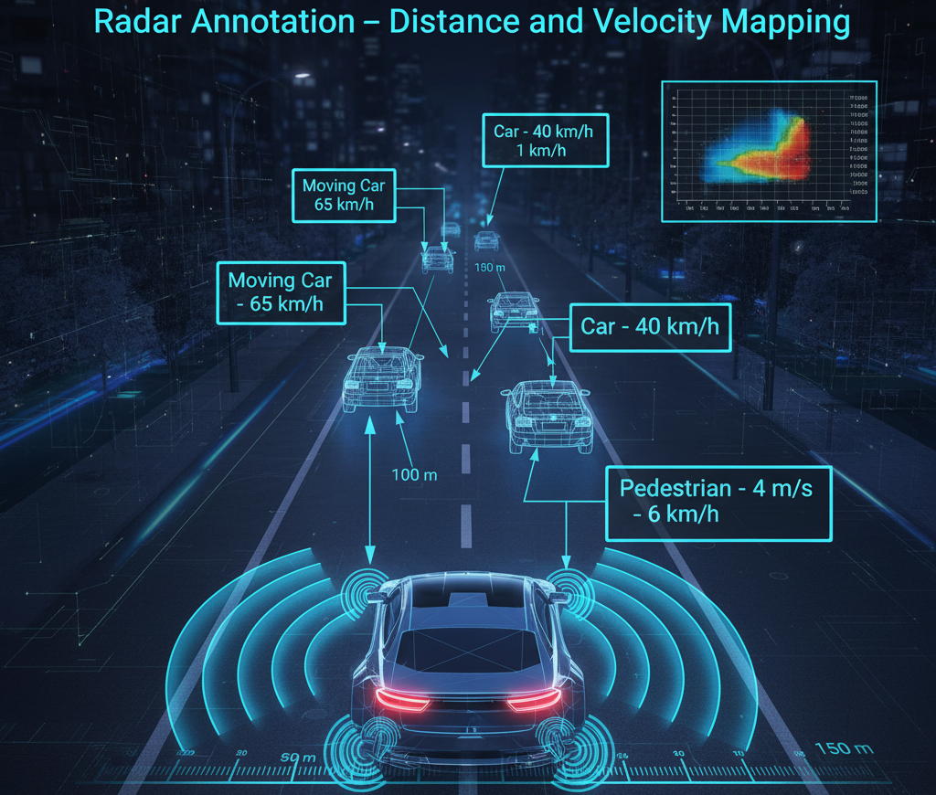
Radar data annotation involves identifying and labeling objects based on radar reflections and motion patterns:
- Object Detection & Tracking – Annotating moving or stationary targets (vehicles, people, obstacles).
- Velocity Annotation – Labeling speed or direction of moving objects.
- Sensor Fusion – Combining radar with camera or LiDAR to improve recognition in low-visibility conditions.
- Region-of-Interest Marking – Highlighting radar reflections corresponding to real-world objects.
Applications of LiDAR and Radar
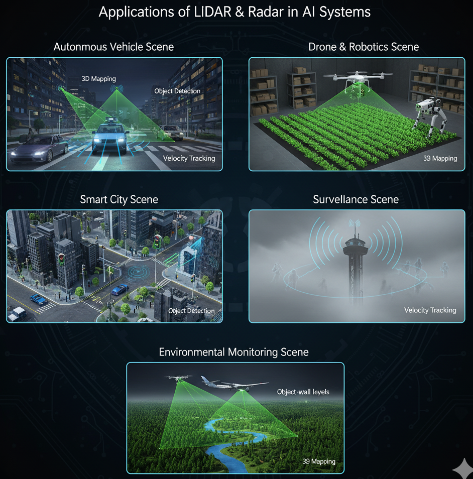
- Autonomous Vehicles – Used together for object detection, obstacle avoidance, and environment mapping; LiDAR provides 3D scene details while Radar measures object distance and speed.
- Robotics & Drones – Enable navigation, collision prevention, and spatial awareness in dynamic or low-visibility environments.
- Smart Cities & Infrastructure – Support 3D mapping, traffic monitoring, and infrastructure inspection.
- Surveillance & Security – Detect and track people, vehicles, or intrusions in all weather and lighting conditions.
- Aviation & Maritime Systems – Assist in terrain mapping, collision avoidance, and target tracking.
- Environmental Monitoring – Used for topographic mapping, forest analysis, flood assessment, and disaster management.
- Agriculture – Support precision farming by analyzing terrain, crop density, and moisture levels.
- Industrial Automation – Enable machine safety, perimeter detection, and intelligent process monitoring.
Quality Control in LiDAR and Radar Annotation
Consistent labeling helps prepare datasets for machine learning. Quality checks may include:
- Following clear object-class definitions and annotation guidelines.
- Reviewing 3D bounding boxes and point cloud labels.
- Checking object associations across frames.
- Validating sensor alignment and synchronization when using sensor fusion.
- Reviewing missing, duplicate, or inconsistent labels.
- Confirming the required output format and project specifications.
The appropriate quality process depends on sensor type, dataset complexity, and project requirements.
LiDAR and Radar Annotation Services by AnnotationWorld
AnnotationWorld provides data annotation services for AI and machine learning projects. LiDAR and radar annotation requirements can be defined around sensor data, target objects, labeling guidelines, quality criteria, and preferred output formats.
Contact AnnotationWorld to discuss your dataset requirements and determine a suitable annotation workflow.
Frequently Asked Questions
What is LiDAR annotation?
LiDAR annotation labels objects and spatial features in 3D point cloud data for applications such as autonomous driving, robotics, and environmental mapping.
What is radar data annotation?
Radar data annotation labels radar detections, targets, and associated measurements to support object detection, tracking, and movement analysis.
What is sensor fusion annotation?
Sensor fusion annotation associates data from multiple sensors, such as LiDAR, radar, and cameras, to support combined perception workflows.
What is the difference between LiDAR and radar?
LiDAR uses laser pulses to measure spatial structure and distance. Radar uses radio waves to detect targets and estimate measurements such as range and relative velocity.
Which industries use LiDAR and radar annotation?
Applications include autonomous driving, robotics, infrastructure monitoring, agriculture, environmental mapping, and industrial automation.