
How Polyline Works
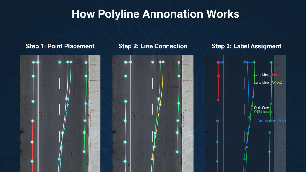
- Point Placement: Annotators click along the visible path of an object (e.g., a road or lane) to create connected points.
- Line Formation: These points are automatically joined to form a continuous polyline.
- Label Assignment: The line is given a class label (e.g., “lane marking,” “river boundary,” “electric wire”).
- Quality Check: Lines are reviewed to ensure they accurately follow the object’s shape or edge.
Polylines can also have attributes like width, color, or curvature to provide richer data for AI models.
Importance of Polylines
Precise Path Representation:
Polylines accurately capture the shape and direction of linear objects such as roads, lane markings, rivers, or cables, offering greater detail than boxes or polygons.
Essential for Navigation Systems:
In autonomous driving and robotics, polyline annotations enable lane detection, route planning, and obstacle avoidance, helping systems follow real-world paths safely.
Supports Infrastructure Mapping:
Used in aerial and satellite imagery to map roads, pipelines, and boundaries with precision for geographic information systems (GIS) and urban planning.
Improves Model Accuracy:
By training AI models with fine-grained, line-based data, polyline annotations enhance edge detection, structure recognition, and feature extraction.
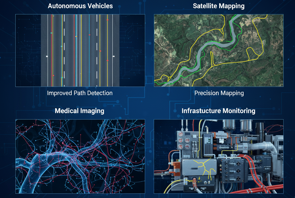
Applications of Polyline Annotation

Autonomous Driving: Annotating road lanes, boundaries, and traffic lines for lane detection systems.
Aerial and Satellite Imagery: Mapping roads, rivers, pipelines, and power lines.
Medical Imaging: Tracing blood vessels or nerve pathways.
Robotics & Navigation: Marking navigation paths or movement trajectories
Infrastructure Inspection: Detecting cracks, cables, or linear defects in machinery or structures.